
Avenues / Ironton (Neighborhood)
Dublin Core
Title
Avenues / Ironton (Neighborhood)
Description
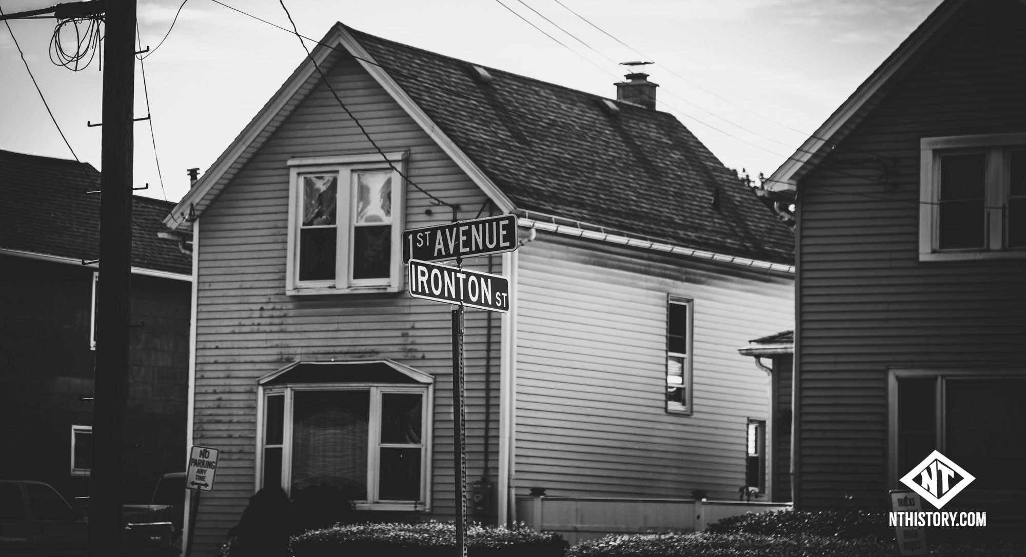 Ironton Street and First Ave in 2024. Photo by Dennis Reed Jr See also: The lost village of Ironton and the birth of the Avenues and Avenues Folk: Mary Kijowski-Konstanty of Fifteenth Ave.
Origins of Ironton
The "spark" for Ironton arrives in 1873, when Niagara Furnace (later Tonawanda Iron and Steel) locates on the banks of the Niagara River near Wheatfield Street. The unofficial village of "Ironton" is named after the promising venture. After initial excitement (and investment in the surrounding land) however, the furnace shuts down after only a year in operation.
Early doings
In 1875 map, homes are seen in the lower Avenues. Oliver Street business? Churches. Colonel Payne's estate is still intact across Payne and up to Dahlgren Place, the former northern limit of the early Avenues. Ironton Street from 1880s according to ArcGIS.
"From 1880-1890, its population increased form 1,492 to 4,793," (Biographical and portrait cyclopedia of Niagara County, New York, p.110).
In 1882, the establishment of a John Cichoki's tavern on River Road near Wheatfield street is a foothold for early Polish settlers. Grocers and butchers are nearby. In 1884 a "minor school in a small frame building" is established less than a quarter mile east down Wheatfield at Dahlgren Place (Buffalo Courier Express, 1905). In 1889 or 1890, the much larger, Richardsonian Romanesque style Ironton Public School #2 opens at the corner of 1st Ave and Oliver Street.
The furnace burns again; the River Road industrial corridor
The old Niagara Furnace site is expanded and relaunched in 1889 by Tonawanda Iron and Steel. The adjacent marshes and former farms once again become valuable real estate, with "manufacturing interests" courted for the valuable land along the river and railroad tracks. More Poles, Hungarians and others flock to the Avenues, bringing their languages, traditions and chickens with them. An 1891 guidebook describes the real estate situation:
It was purchased from Pratt & Jewett by Geo. P. Smith and A. J. Hathaway, Oct. 15, 1889, replatted, and Jan. 1st, 1890, put on the market. Within a year 500 building lots had been sold and 100 houses erected.Land
With June of the present year [1891] the Ironton Land Co. was incorporated with capital of §100,000 and everything bids fair for a prosperous career, as this is the river center of North Tonawanda corporation, and being traversed by all the rail- roads it cannot fail to secure prominent manufacturing interests.
The Ironton addition is less than a mile from the North Tonawanda City Hall. With the Iron & Steel Works, the surrounding lumber interests and the bolt and nut works of Plumb, Burdict ct Barnard, which has recently been located on the adjoining property, this section of the city will make a convenient and desirable place for mechanics and business firms. It has the water supply, electric lights, and will soon be connected by the electric street car line.
A double two story brick block for stores has just been completed on Oliver street, making a nice addition to the mercantile conveniences there, a $15,000 brick school house was erected a couple of years since, a church dedicated in August and this section has all the modern conveniences of the older part of the city.
In November 1889, George P. Smith and A. J. Hathaway buy land opposite the iron works.
Incorporation into the City of North Tonawanda
The village of "Ironton" (along with the villages of North Tonawanda, Gratwick and Martinsville) is incorporated into the City of North Tonawanda in 1897. The last remnant of the old village name is in its "Ironton Street," running along the west edge of the original avenues. It never had its own post office, or government, but it is an interesting part of the patchwork of the original city that has mostly now vanished from public recall.
An increasingly Polish community on the Avenues
For the numerous Polish on the original seven avenues, their church is the center of their community. OLC is established on Center Ave, exactly where the grotto is today. It is later rebuilt just south. Pettit Creek flows through the area (it will be covered).
The paving of Oliver Street being planned August 26, 1893.
A progress report about a month later. October 5 there is labor trouble between Poles and Italians.
The upper avenues remain essentially woods and marshes until the 1940s, when settlement accelerates with the nationwide Baby Boom.
Notes:
* Annual Report of the Superintendent of Public Instruction, of the State of New-York (1884, Google Books) Also has lots of details about new Goundry Street school and a brief mention of Gratwick school and enrollment figures.1890 "The village of Tonawanda is up and awake as far as educational matters are concerned. It has a progressive board of education composed of five members, all liberal men in their views. A new brick school building is nearly completed at Ironton, a suburb of the village, that would be a pride to any town."
John Carr on Facebook in January 2017: "Go back to the 1800's and my great grandfather's farm, as well as several others, was there, extending from the river inland past Payne. The house was originally along the river. Eventually the lumber yards and steel mills pushed the property, and the house back from the river to Oliver (#849 or #869). In the 1890's, after his death, the property was sold off and developed into individual housing lots. At that time the area was annexed to North Tonawanda, before that the area was part of Wheatfield. Carr Street still exists by the town pool. Many of my great grand parents children and their families had homes in the area. We see the area today pretty much as it was developed then, however modernized a bit and not the capitol of industry it was then."
ArcGIS and old map notes:
- 1860 map show Cap. O. Shepard in a few places. From Ohio. Buried there. H(enry) Rosebrock from Hanover, Germany (1880 Census); H. Luttman German. F. Roney
- Homes on Ironton Street range between 1870 (96 Ironton), 1880 (144 Ironton) and into the early 1900s. Some Year 0s (e.g., 188).
- The River Rd - Wheatfield "businesses" at southeast corner are 1900-1930, couple of year 0s, though 1886 map shows SOMETHING there earlier.
- Weston & Son lumber all around in 1886 maps, Stocum & DeGraff south across Summer
- Simson Street: Properties start at 1860 (23 Simson), couple 1880s and 0s. "Rua, Joseph M" listed as owned on many. 1875 map it's called "Judd Ave, and names of homeowners are given (several Simsons); Called "Miller" in 1886 map. Early enclave for nearby mill, predating even Iron Works?
.jpg")
.jpg")
.jpg")
.jpg")

.pdf")
.jpg")
 copy.jpg")

.jpg")
.jpg")
.jpg")
, map detail (1893).jpg")
.jpg")
.jpg")
.jpg")
.jpg")
.jpg")
.jpg")
.jpg")
.jpg")
.jpg")
.jpg")
.jpg")
.jpg")
.jpg")
.jpg")
.jpg")
.jpg")

.jpg")
Tonawanda anarchists, article (Lockport Journal, 1901-09-16).jpg
.jpg")
Connection alleged to McKinley assassin Csolgosz
.jpg")

.jpg")
.jpg")
.jpg")
.jpg")
.pdf")
Police had to guard diggers, article (Niagara Sun, 1908-05-19).pdf
.pdf")
Ironton men unhappy about Gillespie bringing in workers from out of town to dig Lockport line.
AI Transcription:
Tuesday, May 19, 1908
POLICE…
.jpg")
.jpg")
.jpg")
.jpg")
.jpg")
.jpg")
.jpg")
.jpg")
.jpg")
.jpg")
.jpg")
.jpg")
.jpg")
.jpg")
.jpg")
Whiskey still boils over and firemen are summoned, Ironton, article (Tonawanda News, 1921-09-09).jpg
.jpg")
.jpg")
.jpg")
.jpg")
.jpg")
.jpg")
.jpg")
.jpg")
.jpg")
 .jpg")
 .jpg")
.jpg")
.jpg")
.jpg")
.jpg")
.jpg")
.jpg")
.jpg")
.jpg")
.jpg")
Stan's Tavern, 495 River Rid., photo (c1935).jpg
.jpg")
This tavern at 495 River Road would later be Beachy's, and then Ship of Fools. The photo was contributed by John Olszowka, who also supplied the…
.jpg")
.jpg")
.jpg")

.jpg")
.jpg")
Former Hungarian Church, 1st and Oliver, photos (Dennis Reed Jr, 2008).jpg
.jpg")
Some night photos of the 1910 former church.
Ironton, North Tonawanda, sketches (Dennis Reed Jr., 2016).jpg
.jpeg")
Illustrations of Dom Polski, Memorial Pool, Buffalo Bolt by Dennis Reed Jr.
Buildings at River Road near Wheatfield Street, former Ironton, photo (Dennis Reed Jr, 2024).jpg
.jpg")
Maps show this block already built up in 1886. A large planing mill was just south in 1893. The former Stan's Tavern (435 River Road) can be seen at…
.jpg")