
Pettit Creek
Dublin Core
Title
Pettit Creek
Description
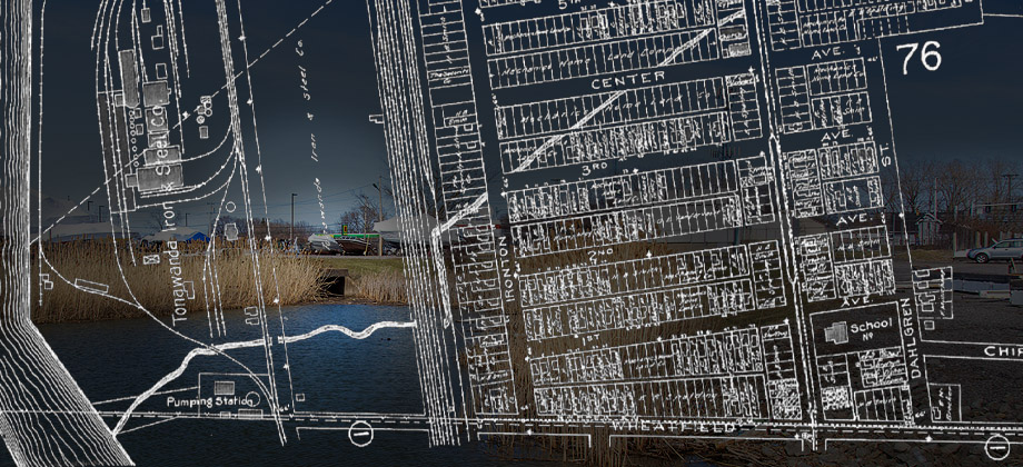 A 1908 map depicts the course of the State Ditch, which was originally Pettit Creek. The background photograph shows the mouth of the creek at the foot of Wheatfield Street. From North Tonawanda Centennial Magazine, 1865-1965:
A lazy little creek flowed into the river near the foot of what is now Wheatfield Street, just opposite the north end of Little Island. On its bank [in 1810] one of our earliest settlers built a log cabin and gave the stream its name. Even today old timers know where Pettit Creek was. It became the state ditch which was made into a storm drain and covered.Partially because residents filled Pettit Creek with tin cans and dead animals, it was covered up in 1925 and converted into a culvert. Soon afterward, Durez (later Occidental) began polluting the waterway properly, with carcinogens and gases that killed fish and exploded basements. In the mid-1980s New York State sued Occidental for its abuse, and several cleanup efforts were undertaken.
Pettit, Joshua (c1780).htm

One of the earliest residents of present-day North Tonawanda. Lived near the Niagara River at present-day Wheatfield Street. Operated a public house?…
.jpg")
.jpg")
.jpg")
.jpg")
.jpg")
, map (1908).jpg")
.jpg")
.jpg")
.jpg")
.jpg")
.jpg")
.jpg")
.jpg")
.jpg")
.jpg")
.jpg")